

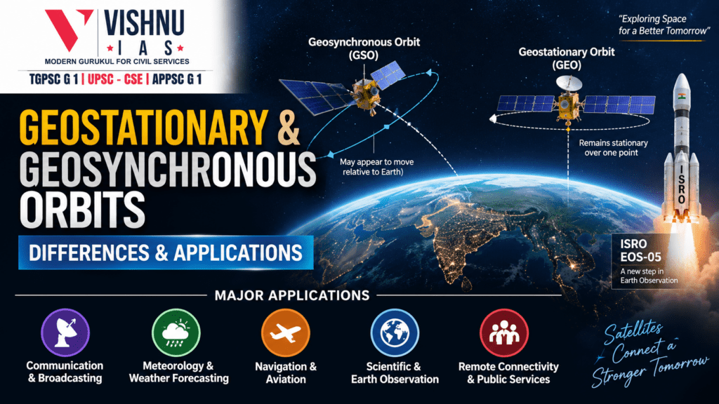
Geostationary and Geosynchronous Orbits: Differences & Applications
Geostationary and Geosynchronous Orbits are important Earth orbits whose orbital period is approximately equal to Earth's sidereal rotation period of 23 hours 56 minutes. While a geostationary orbit is a special type of geosynchronous orbit, the distinction lies mainly in orbital inclination, eccentricity and the apparent motion of the satellite from Earth. Their persistent coverage has made them critical for communication, meteorology, navigation, disaster management and strategic applications.
Distinction between Geostationary and Geosynchronous Orbits
| Basis | Geosynchronous Orbit (GSO) | Geostationary Orbit (GEO) |
|---|---|---|
| Definition | Orbit in which the satellite's orbital period equals Earth's sidereal rotation period. | A special type of geosynchronous orbit in which the satellite appears stationary over one point on Earth. |
| Orbit shape | Can be circular or elliptical. | Circular. |
| Inclination | Can be inclined to the equatorial plane. | 0° inclination. |
| Position | Need not remain above the equator. | Lies above the equator. |
| Apparent motion | May appear to move relative to a fixed point on Earth. | Appears stationary relative to an observer on Earth. |
| Ground position | Does not necessarily remain over one fixed longitude. | Remains over the same longitude. |
| Altitude | For a circular geosynchronous orbit, approximately 35,786 km above Earth's surface. | Approximately 35,786 km above the equator. |
| Ground track | Can show a north-south/east-west movement; an inclined GSO can produce an analemma/figure-eight pattern. | Appears as a fixed point over the equator. |
| Antenna requirement | Tracking may be required if the satellite appears to move. | Ground antennas can remain fixed towards the satellite. |
| Relationship | Broader category. | Subset of GSO. |
Thus, all geostationary satellites are geosynchronous, but all geosynchronous satellites are not geostationary.
Major Applications
I. Communication and Broadcasting
- Geostationary satellites are extensively used for telecommunication, television broadcasting, radio broadcasting, satellite telephony and broadband connectivity.
- Since the satellite remains apparently fixed over a particular longitude, ground antennas can remain pointed towards it, enabling continuous communication with a fixed region.
- Example: India's INSAT and GSAT series have supported telecommunications, television broadcasting and other satellite-based communication services. The U.S. GOES, Europe's Meteosat and Japan's Himawari systems demonstrate the wider use of geostationary satellites for continuous observation and communication-related services.
II. Meteorological Observation and Weather Forecasting
- Geostationary satellites provide continuous observation of the same geographical region, making them particularly valuable for monitoring rapidly changing weather systems.
- They help in tracking Cyclone formation and movement, Cloud development, Monsoon systems, thunderstorms, Atmospheric moisture and Dust and smoke.
- Example: India's INSAT-3D and INSAT-3DR provide meteorological observations for weather forecasting and disaster management. The U.S. GOES satellites continuously monitor weather over the Western Hemisphere, while Meteosat provides similar coverage over Europe, Africa and adjacent oceans.
III. Navigation and Aviation
- Geostationary satellites are also used in Satellite-Based Augmentation Systems (SBAS), which improve the accuracy and reliability of navigation signals.
- Example: India's GAGAN (GPS Aided GEO Augmented Navigation) uses geostationary satellites to broadcast GPS correction and integrity information to aircraft. It improves the accuracy and reliability of aircraft navigation and supports satellite-based landing procedures.
IV. Scientific and Earth Observation
- Geostationary and geosynchronous orbits can support continuous or repeated observation of large geographical areas, making them useful for Earth observation and monitoring of rapidly changing phenomena. Such satellites can provide imagery for agricultural monitoring, Environmental monitoring, disaster management, Strategic and national applications.
- Example: ISRO's EOS-05, launched aboard GSLV-F17 in 2026, is India's first dedicated imaging satellite designed to operate from a geosynchronous orbit at about 36,000 km altitude. It is intended to provide real-time imagery for applications including agriculture, environment and disaster management.
V. Remote Connectivity and Public Services
- Satellite communication from geostationary orbit can extend connectivity to remote, rural, mountainous and island regions where terrestrial communication infrastructure is difficult to establish. Applications include tele education, telemedicine, rural communication and e-governance.
- Example: India's INSAT system has historically supported tele-education, telemedicine and rural communication, demonstrating how geostationary satellite infrastructure can complement terrestrial networks.
Conclusion
The major value of geostationary and geosynchronous orbits lies in their ability to provide persistent, wide-area and repeated coverage of Earth. Consequently, they have become fundamental to telecommunications and broadcasting, meteorology, disaster management, navigation, scientific observation and remote connectivity.