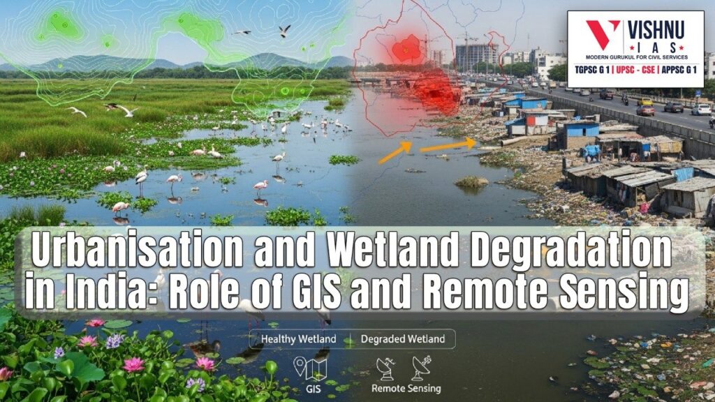
Hydrological Connectivity of Indian Wetlands: Impact of Urbanization and Role of GIS & Remote Sensing
The hydrological connectivity of Indian wetlands is increasingly under stress due to rapid urbanization and persistent administrative lapses. Disruptions in natural water flows between wetlands, their catchments and downstream systems have intensified urban floods, groundwater decline and ecological degradation. In this context, modern tools such as GIS and remote sensing offer critical pathways for diagnosing damage and enabling large-scale wetland restoration.
Introduction:
- Wetlands are land–water interface ecosystems characterised by seasonal or permanent saturation that enables distinctive hydrology, soils, and biodiversity. In India, they include lakes, tanks, floodplains, marshes, mangroves, lagoons, high-altitude wetlands and man-made water bodies, supporting water security, livelihoods and climate resilience.
- National wetland inventories and recent environmental assessments consistently indicate that nearly two-fifths of India’s natural wetlands have disappeared in about three decades, while a significant share of the remaining systems exhibit hydrological disruption and ecological stress.
- Rapid urban expansion, coupled with weak enforcement and fragmented governance, has emerged as a critical driver severing hydrological connectivity — the natural movement of water, sediments and nutrients between wetlands, their catchments and downstream systems.
- Against this backdrop, advances in GIS, satellite remote sensing and geospatial analytics provide new opportunities to diagnose degradation and guide restoration at scale.
Body:
I. Urbanization and Physical Disruption of Hydrological Connectivity
1. Land conversion and encroachment altering wetland inflows
- Rapid expansion of housing, transport corridors and commercial infrastructure has converted wetlands and their feeder channels into buildable land, interrupting surface and sub-surface water movement.
- Example: Bengaluru’s urban lakes – Inter-lake rajakaluves have been narrowed or built over, breaking cascading lake systems.
- Case Study: Chennai floods – Loss of marshlands and obstruction of channels around Pallikaranai reduced flood absorption capacity.
2. Fragmentation of catchments through grey infrastructure
- Roads, embankments and flood control structures often lack adequate hydrological culverts, leading to water stagnation upstream and drying downstream.
- Example: Yamuna floodplains – Channelisation and embankments disconnected wetlands from seasonal river flows.
- Case Study: Peri-urban Hyderabad – Elevated road networks altered runoff pathways and increased sedimentation.
3. Over-extraction and altered water regimes
- Urban demand drives groundwater over-extraction and diversion of surface flows, changing wetland hydroperiods critical for biodiversity.
- Example: Tamil Nadu tanks – Reduced inflows shortened inundation periods.
- Case Study: Wayanad kenis – Declining recharge linked to land-use change threatens traditional wells.
II. Administrative and Governance Lapses Weakening Connectivity
1. Delayed notification and boundary ambiguity
- Weak or delayed legal notification allows encroachment, while outdated cadastral maps fail to reflect hydrological realities.
- Example: Urban lakes across States face construction within drainage zones.
- Case Study: Restoration disputes arise due to lack of participatory boundary demarcation.
2. Sectoral silos and fragmented planning
- Multiple agencies manage wetlands independently, leading to inconsistent water flow decisions.
- Example: Stormwater drains prioritise rapid disposal over wetland storage.
- Case Study: Coastal lagoons weakened by port and tourism projects ignoring ecological flows.
3. Capacity and monitoring deficits
- Institutional shortages and limited technical capacity constrain enforcement and hydrological assessment.
- Example: Management plans often focus on beautification.
- Case Study: Untreated sewage inflows replace natural water, triggering eutrophication.
III. Role of GIS and Remote Sensing in Diagnosing and Restoring Connectivity
1. Mapping hydrological networks and change detection
- GIS and satellite imagery enable accurate mapping of wetland boundaries, catchments and feeder channels.
- Example: National wetland inventories using time-series analysis.
- Case Study: GIS-guided reopening of blocked urban lake channels.
2. Monitoring hydrology, inundation and ecological health
- Remote sensing tracks water spread, hydroperiod and vegetation dynamics.
- Example: Improved urban flood forecasting.
- Case Study: Mangrove monitoring for shoreline and vegetation change.
3. Decision support for participatory and basin-scale restoration
- GIS integrates hydrology, land use and socio-economic data for scenario modelling.
- Example: Wastewater planning aligned with wetland thresholds.
- Case Study: Public geospatial platforms strengthening community stewardship.
Conclusion:
- The erosion of hydrological connectivity in Indian wetlands reflects rapid urbanization combined with administrative inertia.
- Urban floods, groundwater decline and biodiversity loss demonstrate the cost of disconnected wetlands.
- GIS and remote sensing, when embedded in coordinated governance and participatory planning, can restore wetlands as functional systems.
- Strengthening notification, safeguarding catchments and reconnecting flows can enhance water security and climate resilience.
Recap: