NAVIC
- The Indian Space Research Organisation (ISRO) and its commercial arm Antrix Corporation Ltd. are set to commercialize India’s regional navigation satellite system – Navigation in Indian Constellation (NavIC).
Potential Uses:
- Terrestrial, aerial and marine navigation;
- Disaster management;
- Vehicle tracking and fleet management (especially for mining and transportation sector);
- Integration with mobile phones;
- Precise timing (as for ATMs and power grids);
- Mapping and geodetic data
Navigation in Indian Constellation
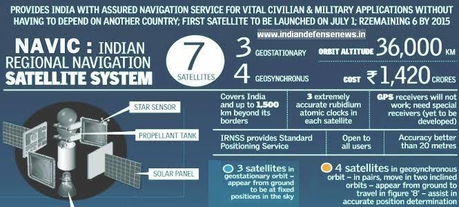
- Navigation in Indian Constellation (NavIC) is an Indian Regional Navigation Satellite System (IRNSS), developed by the Indian Space Research Organization (ISRO).
- IRNSS consists of eight satellites, three satellites in geostationary orbit and five satellites in geosynchronous
- The main objective is to provide reliable position, navigation and timing services over India and its
- It works just like the established and popular U.S. Global Positioning System (GPS) but within a 1,500-km radius over the sub-continent.
- It has been certified by the 3rd Generation Partnership Project (3GPP), a global body for coordinating mobile telephony